| |
|
|
|
|
|
|
|
|||
| |
|
|
|
|
|
|||||
| |
|
|
|
|
|
|
|
|
|
|
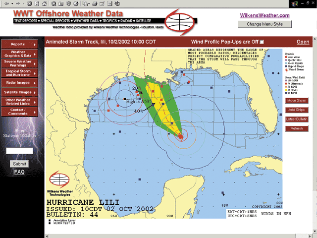
Range Rings are the new feature for this hurricane season. Range Rings allow you to graphically determine the distance of critical wind speeds and the eye of the storm from your location. Using the range rings feature, you can determine if and when the location of the storm requires you to implement the next step in your contingency plan. How does it benefit you? You define your critical parameters. Graphical presentation of those parameters allows your people to maintain production as long as possible and still know they have time to get out safely. How does it work? The storm track appears with rings around the eye of the hurricane. These rings represent various wind speeds, including gale and hurricane force winds. You add range rings around your site at distances dictated by your hurricane contingency plan or at distances you select. You animate the storm through its projected path to graphically depict the projected wind speeds at the crucial ranges you defined.
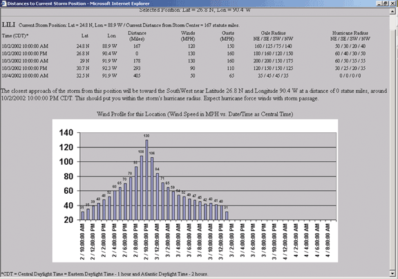
Select "Wind Profile Pop-ups are On" to see the forecasted winds for any location you select and click anywere on the map.